Selhausen agricultural station
The Selhausen site is part of the TERENO Observatory “Eifel/Lower Rhine Valley Observatory” and is one of the few European measuring stations certified as an ICOS Class 1 Ecosystem Site—the highest classification level within the European ICOS network. Selhausen was one of the first sites to be awarded the official ICOS label in 2019. This certification stands for the highest standards in terms of data quality, standardization, scope, and long-term nature of the measurement program and underscores the site's special role in European climate research.
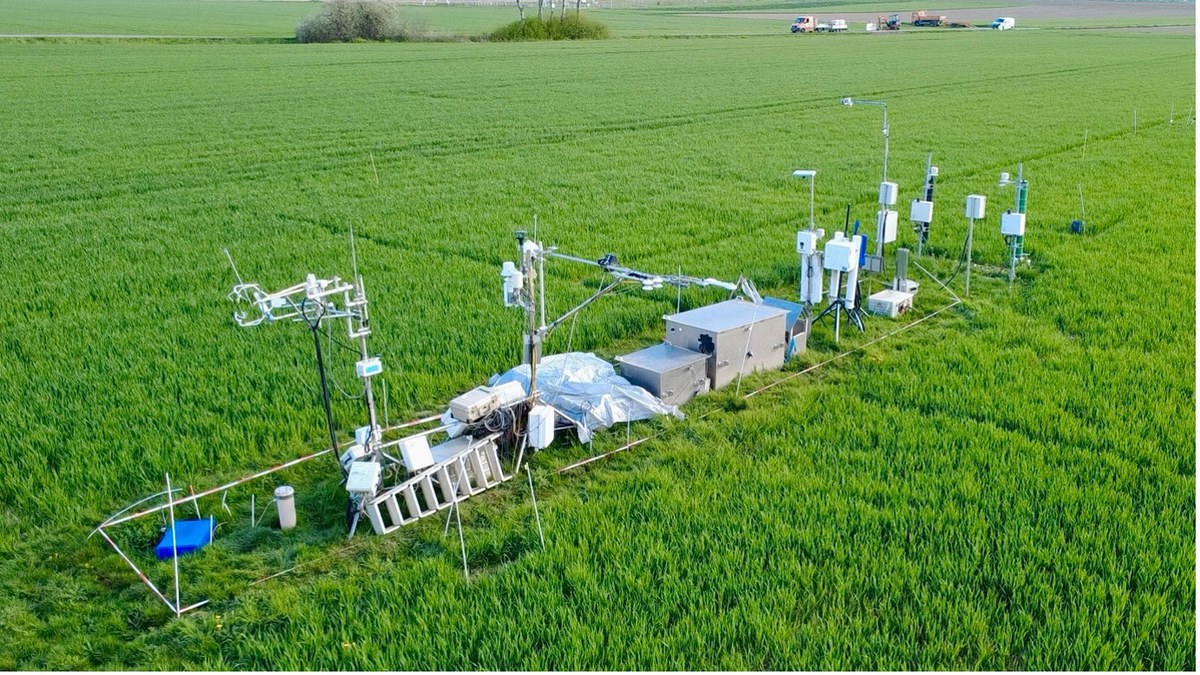
Selhausen is located in the agricultural region of the Jülich Börde with fertile loess soils and main crops such as sugar beet, winter wheat, winter barley, corn, rapeseed, and grassland. Since 2007, the area has served as a test site for measurement campaigns to analyze the water, energy, and carbon cycles between the soil and the atmosphere. In addition to continuous greenhouse gas measurements using the eddy covariance method (e.g., CO₂ and H₂O), numerous other measurements are carried out. These include meteorological parameters such as temperature, humidity, wind speed and direction, soil moisture and soil temperature at various depths, and radiation balance components (global radiation, reflection, long-wave radiation).
Vegetation development is comprehensively monitored, including through phenological observations and regular specific field campaigns, in which parameters such as leaf area index (LAI), above-ground biomass, and the nutrient content (e.g., nitrogen) of plant stands are recorded.
In addition, the site is used by various national and international project partners who employ complementary measurement systems and technologies. These include cosmic ray neutron probes for comprehensive soil moisture measurement, FloX systems for continuous measurement of sun-induced chlorophyll fluorescence as an indicator of photosynthetic activity, and electromagnetic induction measurements (EMI) to investigate soil heterogeneity (e.g., conductivity, texture, moisture distribution). Multispectral drone flights are also used regularly to derive vegetation indices (e.g., NDVI) and for targeted spatial recording of plant development and stand heterogeneity.
Regularly updated data on the site can be accessed via the following data portals:
Further information:
Short video clip about the intensive measurement site in Selhausen
The station on the website of the German ICOS community (ICOS-D)